/ Colonisation Mechanism
Colonization Mechanism is a decision-making and planning-support tool for the transition of former lignite mining areas to urban agroecosystems. The strategy actively connects local communities – the socioeconomic environment, its actors and processes – with the physical environment – its developmental patterns and life cycles. Modeling them into an ecosystemic continuum generates more resilient, dynamic, and adaptive urban agroecosystems from planning to management to construction.
________________________________________
#mechanisms
01.GENERAL SCHEMA
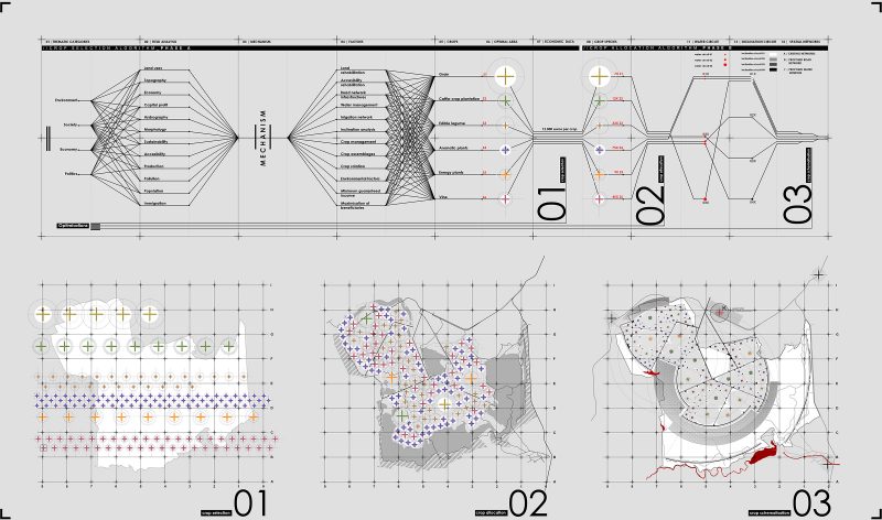
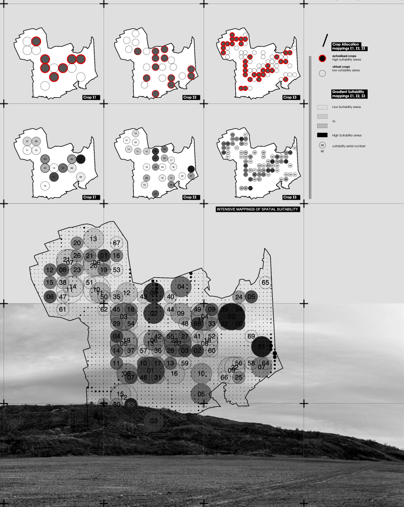
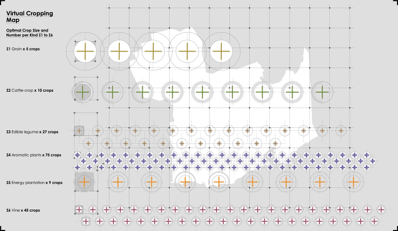
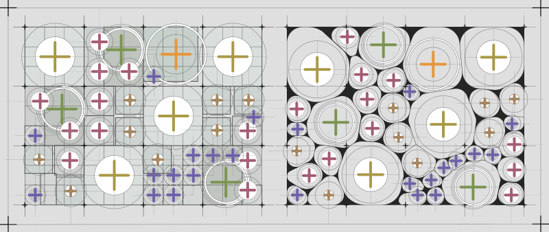
The mechanism processes information and reorganises its structure to adapt to the landscape’s transition and rehabilitation, through a 3-phase algorithmic process. In the first one, the selection phase, the algorithm selects the number and type of crops aiming at the area’s economic sustainability. Moving into the allocation phase, the algorithm maps the optimal positioning of each crop by correlating their suitability maps with available natural resources thus pointing to the ecosystem’s environmental sustainability. In the third and final schematization phase, the algorithm precisely defines each crop’s boundaries in relation to all other while at the same time exploring the full range of their possible future formations.
______________________________________________________
what
COLONIZATION MECHANISM
PANHELLENIC COMPETITION
______________________________________________________
how big
6.5×5.5 Km
______________________________________________________
why
MATERIALIZE AFFORDANCES
______________________________________________________
where
AMYNTAIO, KOZANH
WEST MACEDONIA
______________________________________________________
process
01.GENERAL SCHEMA
02.ALLOCATION PROCESS
03.SCHEMATISATION PROCESS
04.OPEN-SPACE FRAMEWORK
______________________________________________________
______________________________________________________
______________________________________________________
mapping visualisation | 2019
3-PHASE ALGORITHMIC PROCESS
mapping visualisation | 2019
COLONISATION MECHANISM | OPEN SPACE FRAMEWORK
________________________________________
#fields
02.PRODUCTIVE DYNAMICS
Colonization Mechanisms innovation lies in monitoring, visualizing and utilizing the environment’s productive dynamics, pointing both to the local communities (biotic) and the physical environment (abiotic). By simulating environmental, economic and social dynamics in real-time, the mechanism algorithmically generates the optimal spatial and material organizations of urban agroecosystems. It is a multi-parameter, computer-based model to be used as dynamic decision-making and planning-support tool, with the capacity to straddle the complexities of urban agroecosystems, in a short time and in a “self-conscious design process. It can be simultaneously applied across different areas and scales while at the same time actively connecting its multiple agents and their perspectives.
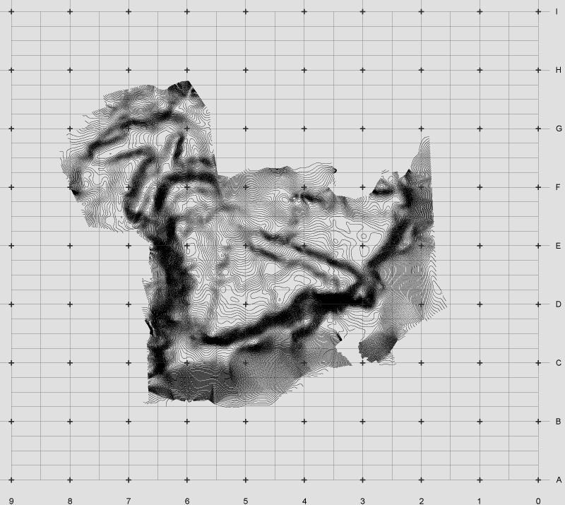
INITIAL GROUND
mapping visualisation | 2019
NEW GROUND | SECTIONS
mapping visualisation | 2019
GROUNDS' SUPERPOSITION | SECTIONS
mapping visualisation | 2019
GROUNDS' SUPERPOSITION PROCESS
mapping visualisation | 2019
GROUND DIFFERENTIAL FIELD
mapping visualisation | 2019
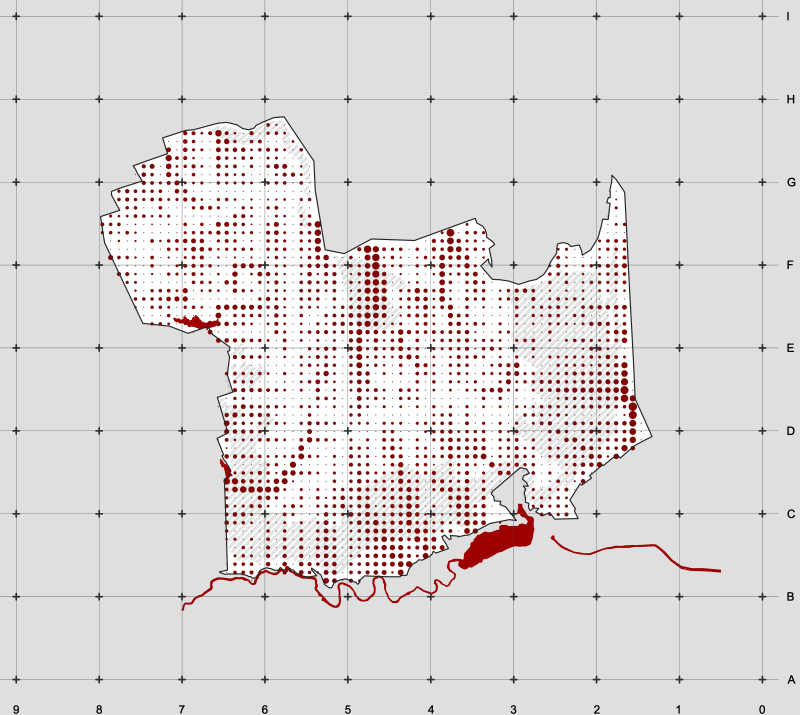
SURFACE WATER ANALYSIS
mapping visualisation | 2019
SURFACE WATER DIFFERENTIAL FIELD
mapping visualisation | 2019
INCLINATION DIFFERENTIAL FIELD
mapping visualisation | 2019
VIRTUAL MAP
________________________________________
#affordances
03.SELECTION / ALLOCATION / SCHEMATISATION PROCESS
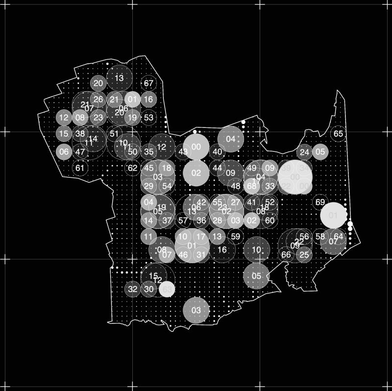
Throughout its life-cycle, the dynamic cropping system processes information regarding the physical environment (edaphic and climatic data) and local communities (population and economic dynamics) and re-organises its structure to adapt to the transition and rehabilitation of the landscape. Identifying the optimal potential positions of individual crops regarding available natural resources (surface water analytics, inclination, soil management, climate), the scheme increases its environmental resilience. By integrating both local and broader economic dynamics (each crop’s minimum annual income, number of land-owners, needs in the food industry and public/private funding potentials) the algorithm sets the frame for the area’s economic self-sustainability.
WATER AFFORDANCES
mapping visualisation | 2019
WATER AFFORDANCES | CROP SUITABILITY MAP
mapping visualisation | 2019
INCLINATION AFFORDANCES
mapping visualisation | 2019
INCLINATION AFFORDANCES | CROP SUITABILITY MAP
mapping visualisation | 2019
ABIOTIC AFFORDANCES | CIRCUITS' MAP
mapping visualisation | 2019
CROP ALLOCATION ALGORITHMIC PROCESS
mapping visualisation | 2019
POTENTIALITY MAPS | CROPS S1,S2,S3
mapping visualisation | 2019
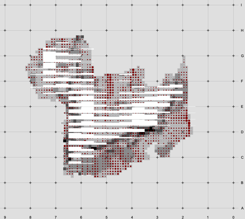
ACTUAL/VIRTUAL CROPS | GRADIENT SUPERPOSITION
mapping visualisation | 2019
SOCIOECONOMIC AFFORDANCES | PHASE A
mapping visualisation | 2019
CROP ADAPTATION MAP
mapping visualisation | 2019
MECHANISM'S SPATIAL ELEMENTS | SYNAPSES, NODES, FIELD CONDITIONS
mapping visualisation | 2019
CROP ADAPTATION MAP | PHASE B
mapping visualisation | 2019
SCHEMATISATION PROCESS
mapping visualisation | 2019
FINAL SCHEMATISATION | SET BOUNDARIES
mapping visualisation | 2019
SCHEMATISATION | PHASE C
mapping visualisation | 2019
OPEN SPACE FRAMEWORK | EVENT 01
______________________________________________________
what
COLONIZATION MECHANISM
PANHELLENIC COMPETITION
______________________________________________________
how big
6.5×5.5 Km
_____________________________________________________
why
MATERIALIZE AFFORDANCES
______________________________________________________
where
AMYNTAIO, KOZANH
WEST MACEDONIA
______________________________________________________
process
01.GENERAL SCHEMA
02.ALLOCATION PROCESS
03.SCHEMATISATION PROCESS
04.OPEN-SPACE FRAMEWORK
______________________________________________________
______________________________________________________
______________________________________________________
__________
